TROUBLESOME RISING DIGITAL ANTHOLOGY
Floodwall Murals: Ways of Showing and Living with History
Georgiana Janko
Floodwall murals are the coherence of reciprocal efforts by floodwalls and outdoor murals. Floodwalls are at work in many riverside communities, constructed by way of federal, state and local capital in response to catastrophic flooding and anticipation of recurrence. Applied with various motivations by a variety of artists, some of these walls are adorned with murals. An inventory of these murals spans many different images and stories, perspectives and compositions, with common and divergent contexts. While these vary in background, scope and functionality, the floodwall is categorically consistent. Considering floodwall murals as constituting floodwall and mural, we can begin to work out a theory of what they are doing as a compound phenomenon, exploring the agendas, origin stories, and provocations for their amalgamation and varied components.
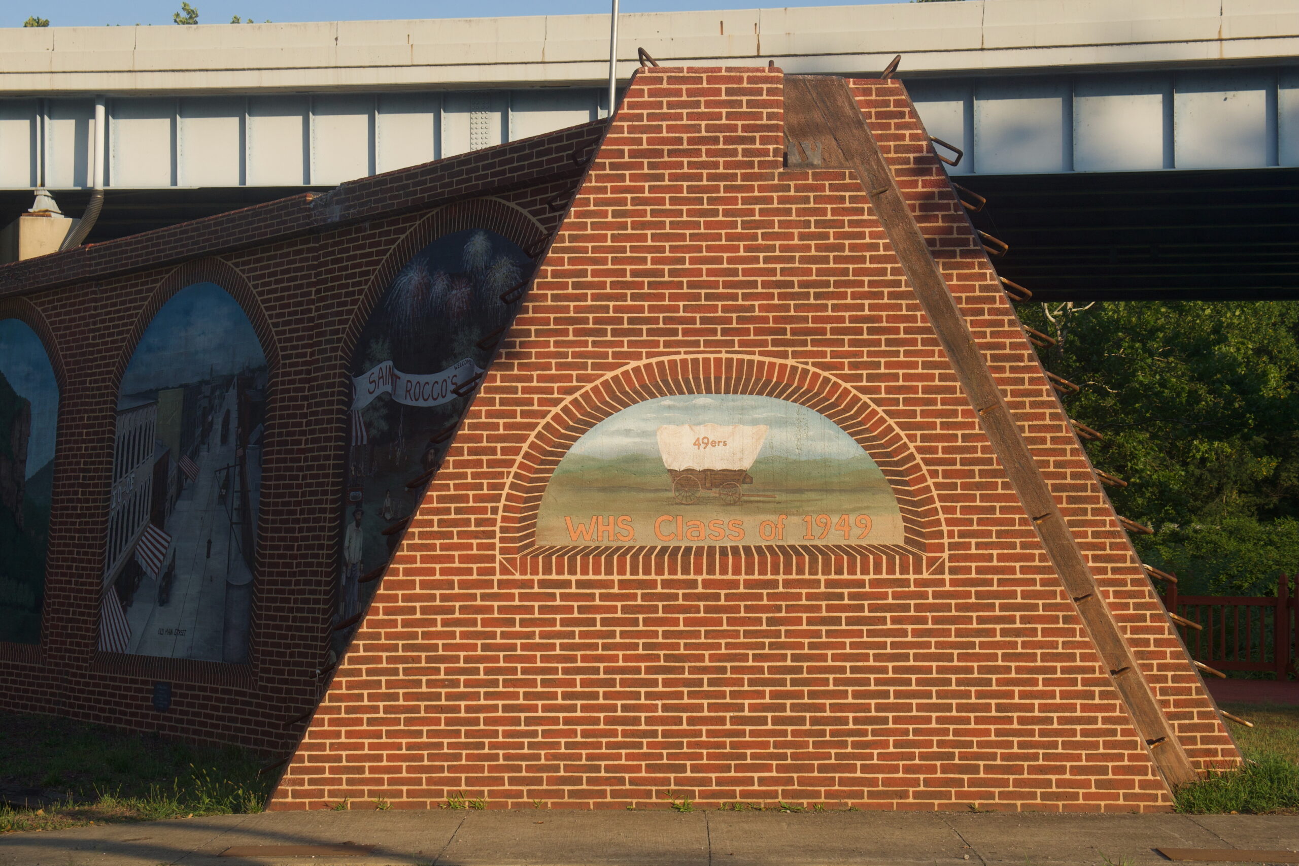
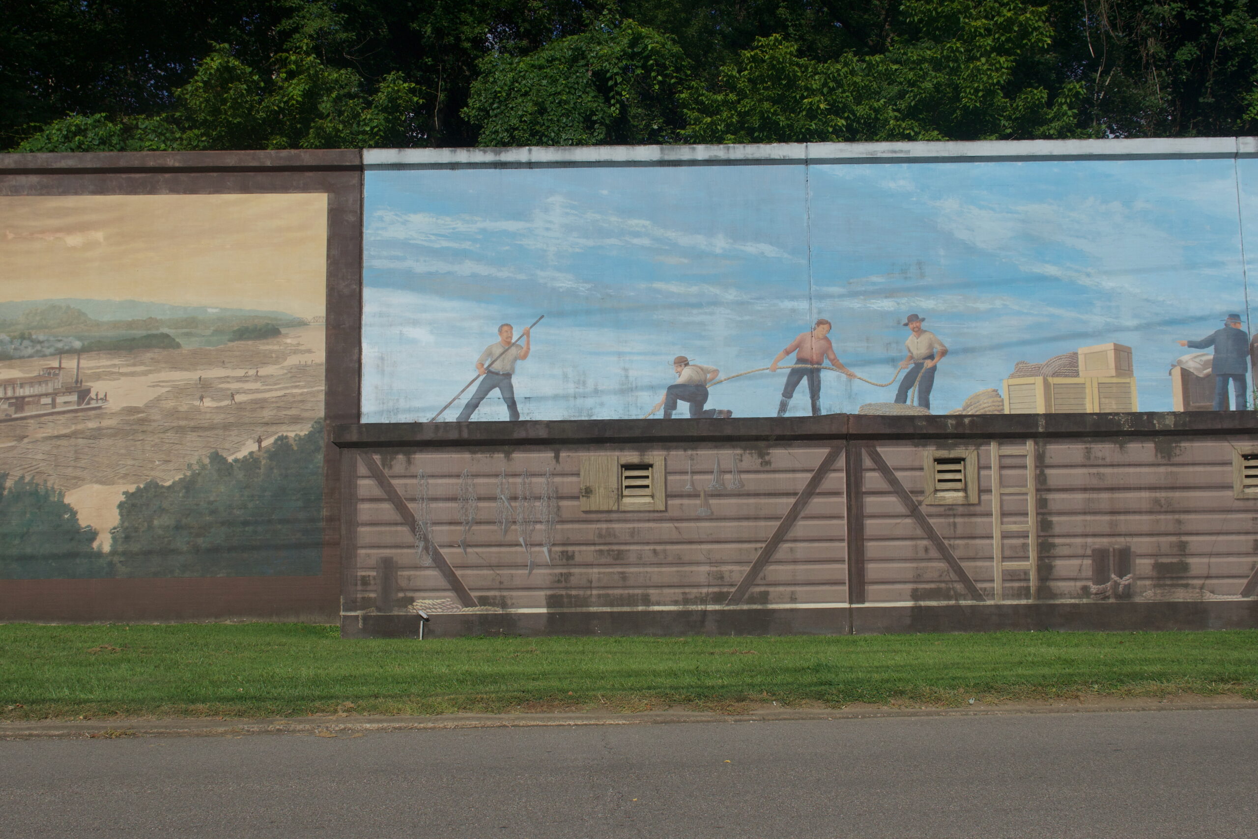
Standing alone, the floodwall acts as a massive reminder of the past, of a destructive episode, placed along banks where the waters’ rise contours a town’s vulnerability. From this perspective, the mural acts as an intervention, a change in narrative from a sort of dreadful looming to a celebratory haunting; the past returning to the present; the water level of a hundred-year flood ensconced in the imagination of this colossal barricade; a present invincible from the eyes of the past. Floodwalls protect. They also stand as a sort of memorial, a mantle of grief, its potential, its preventability. What is at stake for wall and mural may differ, but in their physical attachment there is a conceptual installment of each into the other’s project; what emerges is what they are, together. To approach the wall is to approach the mural, to approach the mural is to approach the wall. In Matewan, WV, this integration is palpable; the mural is made in unison with the wall, sharing the medium of cement, appearing as a three-layer scheme of texture from which the illustrations emerge. As tactical and physical entities, they do more than augment one another, they become one another.
The murals offer a sort of argument, a defense for the defense, a show-and-tell of what the floodwall is fighting for. As a securer of the settlement, the imagery placed upon their surface imbeds itself into this task. Murals that display historical scenes, such as Matewan’s, install those subjects into the infrastructure of preservation. With murals often as efforts in themselves to preserve history, biographical floodwall murals play out a dual valence, saving the past via the future and the future via the past. Implicit and explicit in this apparatus is a proposal of what is to be saved; how far its protection extends, what is excluded, geographically and conceptually, in the walls blocking and in its depictions. These choices are not arbitrary, rather, more often they are labored over diligently throughout a planning process. Public art like this must get permission as well as capital, both processes that bring many voices into the decisions.
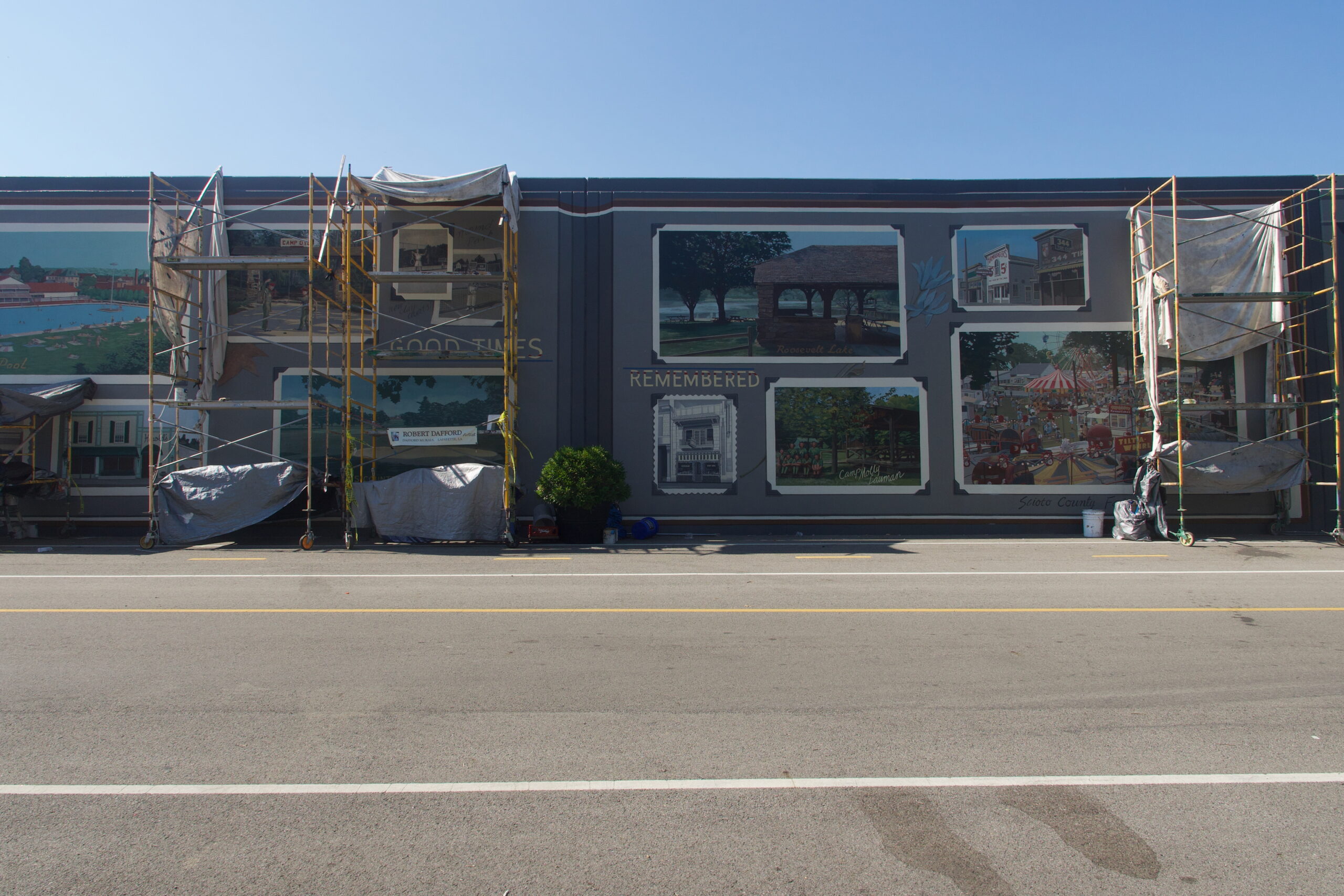
Overall, the murals have eclectic funding sources. Some, such as Parkersburg, WV, Point Pleasant, WV, and Portsmouth, OH, raised funds through donations and grants to the committee’s or non-profit’s budget, maintaining their decision-making authority over the commission of the artist, Robert Dafford. Others, such as Wellsville, OH, solicited donations from individuals, families, or organizations, who then served as sponsors for individual murals. In these cases, the donors gave with specific instructions for the mural they wished to support. In this format, many of the murals have corresponding placards indicating the patron and details of the chosen subject. Placing topical sway in the hands of the benefactor has the potential consequence of the history being presented in keeping with the donor’s request. The degree of artistic autonomy within this framework likely varied from project to project, but it is concerning to consider these donations as ways of promoting a well-resourced world view. As a partial explanation of murals’ sources, it does not entirely preclude a dialogical or even dialectical process. Dafford noticed the one-sided quality of the stories given to him in Portsmouth and went about his own fieldwork to compensate. He may not have changed the committee’s vision of the position from which they were looking, but his encouragement had an influence on expanding the directions of the gaze. Wellsville artist, Gina Hampton, responded to the observation that the mural had only white faces, by incorporating as many races and ethnicities as she could, leaving the representations vague. With more contentions, Newport, KY’s mural was halted at the planning stage: depicting slave owner and city founder, General James Taylor. What is at stake in these moments is more than just faithfulness to record, but realization of what record, whose record, is being consulted.
The way in which the murals tell history is just as important as the punctuality of the facts. As we have seen, the floodwall itself is a defender of settlement, an emblem and effect of living off the river, of harnessing its capacities. Many of the riverside communities depend economically and infrastructurally on rivers as part of the intermodal webbing of the United States and the international waterway system. Rivers and floods are a part of the way of life.
Floodwalls are already a mediator between inside and outside, between subsumed and subsuming, or submerged and submerging. They are a sort of membrane, allowing people in and out, but stopping the river. For example, Wellsville, OH’s floodwall mural is on the wall along a tributary of the Ohio River (the source of the flood-watch concern), which is intersected by one of three ways into town. The mural is painted on both sides of the floodwall as well as smaller walls along the entry road. Here the mural is part of a gateway into town. As an entrance, its images offer their impression to the mind before coming face-to-face with their contemporary instance. Ashland, KY’s floodwall mural runs on two segments of wall, one perpendicular to the river following the road that offers river access, read right to left, away from the river, and on the other side of the road, parallel to the river, on the outside, while facing the Ashland Train Depot on the riverside of the wall. Generally, the murals are a public interface, the way a town wants to represent itself to itself, to its future, and to the tourist. By assuming an audience, the other is automatically invoked, and whether intentional or not, the othering is detailed further and further with each compositional gesture.
Along with murals’ reputation for revitalization, as sighted in many town bulletins about their mural projects, what is depicted on the floodwalls declares itself as content capable of participating in sustaining its place of subject. What is shown is what the place stands for; ‘stands for’ in the sense of ‘owing its standing to’ (both by way of the lore of a town’s founding and a town surviving a flood because of the floodwall) and ‘stands for’ in the sense of ‘gets behind’ (literally, in a flood, the town is behind the wall… ergo: the town is defending itself as defending its history, defending itself by means of its history, the history is defending the town and the history is defending itself). Here, behind is an orientation, but not a definitive one. It is just as plausible that the town is in front of the wall, the way it would appear standing in town, facing the river. Likewise, the floodwall “has your back” in the sense that it is doing work, standing guard even when no one is looking, “has your back” in the sense that its messaging bolsters you, and “has your back” as similar to the first case, it is literally behind you, the town and land ahead. In a way this comes out to be a question of perspective; are you in town, on the river, on the other side of the river? Further, where the “you” is might depend on who the audience is and/or where the audience is imagined to be.
Physically, if a floodwall has an inside and an outside, the inside being the side away from the water and the outside facing it, how might the placement of its murals establish tone, a sense of the speaker and spectator? It is reductive to assume that murals on the outside of their walls are directed more towards “outsiders” and the inside vice versa, or that creations on the outside of the walls are subject to more inclement conditions. Many inside murals get brutal winds and baking sunlight. The sense that the outside is exposed is a more social one, like writing on the outside of your house versus a living room wall, and knowing that there is that 1% chance that the entire exterior, including your portrait, might wind up underwater. A small part of your brain, or your child’s, might wonder how the characters will breathe, how long they will stay under there, and seek out calming messages from the inside landscape. There is an immediate situation of the audience that places them outside of town in order to perceive the outside murals and inside town in order to perceive the inside ones. However, taking up this position, during a 99%-of-the-days day, may be as simple as walking from one side to the other. The mural may only be part of the occasion to do so. Many of the outside murals seem conscious of the attraction of the river vista and the recreation that river access offers, including parks with boat launches, and picnic, play, and walking grounds.
View is primary to the aesthetics of these murals. As they assume roles as beautifiers, it is in response to the walls’ starkness. Images on the outside of the wall become a way of seeing town, of seeing what the town stands behind, possibly your first impression if you are arriving by boat. Some include a named invitation to the town, a welcome message, almost like title cards, on the outside, like Parkersburg, WV and Point Pleasant, WV. However it is unclear to me just how visible these messages actually are from the river. From the lower walkways, the view of the murals is occluded by the slope of the riverbank, bushes and parked cars. (Likewise in Wellsville, OH and Ashland, KY the murals are rather remote from the river.) From the inside, floodwalls block the river. Being a barrier against the water, the bulk of their concrete posture visually blocks the view of the river (at least from the low ground for the sake of which the wall exists). The murals compensate with an alternative panorama.
Along with its face, different murals seem to lend themselves to being taken in from different distances or stances. Robert Dafford describes how he actively distorted the image so that its perspective is aligned with a walking pedestrian. (Not that a couple of feet would be that noticeable, but this makes me wonder about the height of the eyes of his designated spectator.) Scale may be larger than what can be taken as a whole from up close, spelling out words or images across segments (many around 25 feet each). For example, facing the beginning scenes of Point Pleasant, WV’s and Parkersburg, WV’s murals made me feel like I needed to keep stepping back to such an extent that it would have been more coherent if I had been on the river. Similarly, in Matewan, the path is directly at the foot of the towering wall. My neck strained to take in even a single panel in one look, however crossing the bridge to Kentucky offered the alternative obstacle: the tree line blocking a comprehensive view. This form cannot be witnessed at one glance. It unfolds, like an accordion book stretched out along the bank. Walking, driving, boating alongside is when the totality begins to emerge. It requires one to take a journey with it, to travel alongside, taking it in, frame by frame. For the historical, the frame-by-frame notation of what befell. Your ability to integrate one picture with the next may depend on your distance to the wall, physically and conceptually, through motion or withdrawal, this effect begins to dissipate.
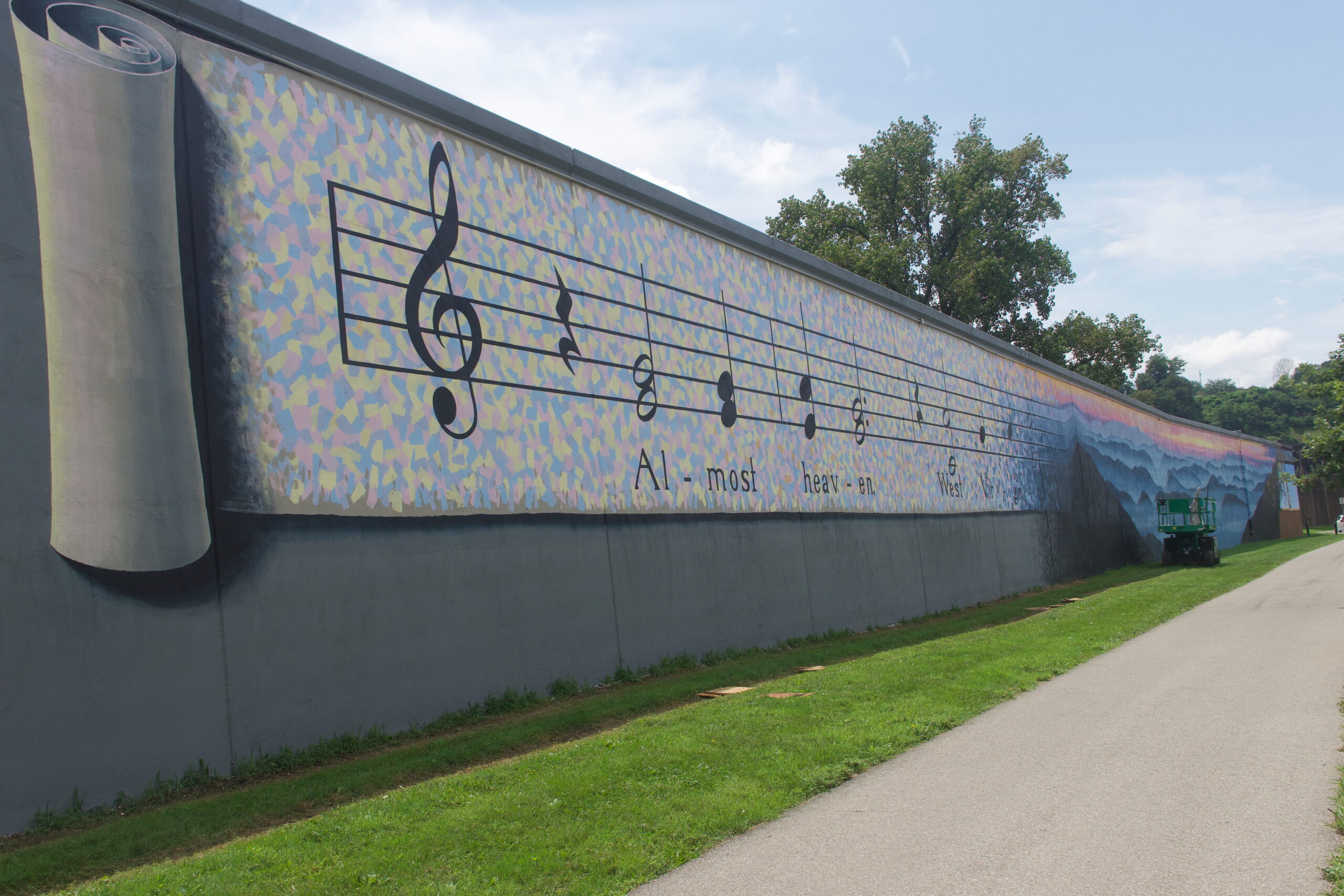
Even if history is not what is being aimed at, a floodwall’s consistent height and extensive length resists non-linear storytelling. Depending on which side of the wall the mural stands, and which side of the river the town stands, a timeline running left to right may ascend along the grain of the river or against it. As the river flows with a tendency, a progression, a production of motion from upstream to downstream, walking parallel and in the same direction might distribute that feeling to the viewing of the art in that direction. If a mural has a linear progression through time, and it aligns with the river, one might feel as if the river itself is reading, that the flow of water propels the narrative arc, a wind at your back so to speak. If a mural has a linear timeline that is opposite to the flow of the river, the setting could deliver a sense of a tracing backwards or an opposition, a battle between currents, as you witness the town’s development. If the murals are nonlinear, the direction of the river may impose a narrative continuity, a sense that what is upstream will continually deposit itself downstream, and therefore what is upriver can be traced downriver. Either way the river participates in enforcing a temporality, and the mural’s distribution across the wall depends on traversing in some way.
The means of a story unfolding will only be so effective as it regards the story being chosen. Including depictions of the settler-colonial endeavor and state formation on the wall itself reiterates the view that coloniality “protects” and “sustains” the town and its development.
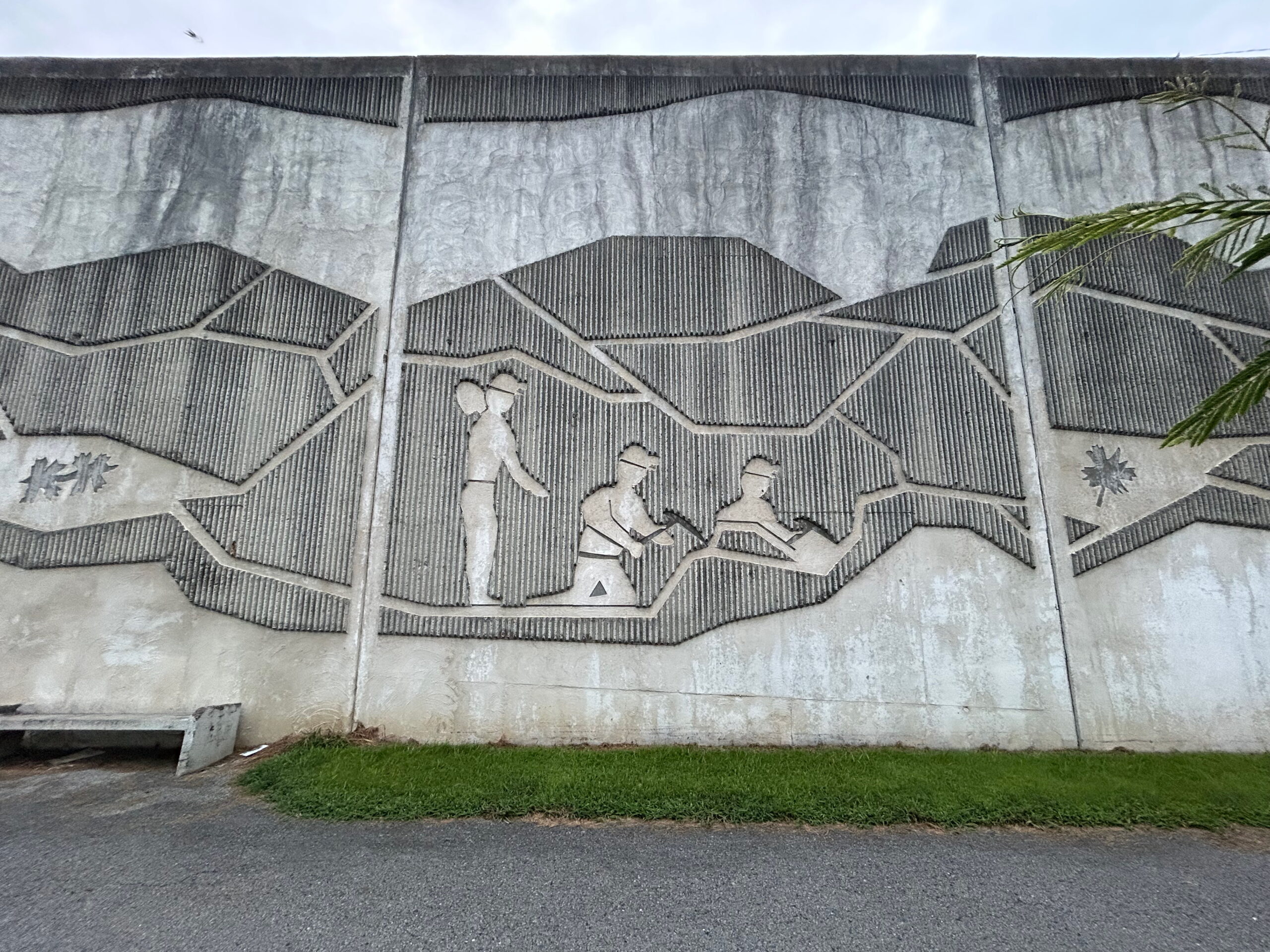
But the work of Black and Brown people in all of these moments is generally not included. Giving the indigenous communities a cameo at the outset is not the same as telling their story, or better yet offering a surface for them to tell their story. Their disappearance after the first few panels of many of these works reflects an “out-of-sight-out-of-mind” ethos. (Note: that there are no federally recognized Indian tribes in Ohio, West Virginia or Indiana. They are not gone, but they have survived colonial displacement and Indian Removals in the 17 and 1800’s). They appear to be there only as a foil for the main characters entering in the following frame. What about the slaves who were made to build the buildings, work the farms, and sustain the industries commemorated in these murals? Much of this art is made to look like the colonizers accomplished it all on their own, not off the backs of Black people.
Gaps, fissures, voids are physical and conceptual. The stories missing blocks of time or coverage altogether are sites of unmarked, unappreciated labor and unacknowledged contributions. These narrative holes are also places that will require work—effort—to fill in. They need their own research, their own memory, their own compensation, a seeking out and interest in what is missing. Physically, substantial cavities in the walls are stations for flood gates, some pre-placed as sliding, fold-up, or hinged; others require manual installation by the fire department, municipal flood control crews, or specialized contractors. The gaps may be openings for railroads, roads, or walkways. Gaps in the floodwall murals may be sights of potential labor, surfaces yet to be painted.
The latter two examples should not diminish narrative significance as neglect. Rather, I offer them as a possible way into a more inclusive, more whole, version of these sights. If voids are spaces ready for additions, potentially, especially in the murals that are spread out, this space can contain a change of course in between what has been set down, to offer an array of perspectives. This potential, the possibility within the open ground, can be read in the way it acts physically. They are also moments of danger, a place where threat can seep in; a floodwall with holes in it is no floodwall at all. Imagine if we considered gaps in history just as menacing, perhaps that is already what happens. Fear not the gap so much as what will come through it; the fear of “rewriting” is a fear that what has been denied entry for so long will find its way, or be invited in, that the history once told will be seen as never having really existed. Like the floodwall, these narratives form a sort of husk, a cast of the zone of threat most often seen as a barrier in the margin between the settled development and its interlocutor. Except, the interlocutor was there first.
It’s worth recalling that the primary interests of these murals and their governors are not historiographic. More often, the first order is preservation, stability, quality of life, attraction, enlivening the status quo. Some places, like Ashland, KY have made more of an effort to show Black lives. I doubt anyone embarked to be historically inaccurate, but they did not set out to tell a complete history, disturbing and all. Many organizers and artists themselves went to local archives as well as door-to-door to gather references, stories, and images. Along with noticing that we don’t always know who got asked the questions, there is also the sense that they set out to present something to be proud of, to show off, to carry forth the legacy of prosperity; to post a kind of seance-meets-vision-board.
Prominent is a concern for property value; physically preventing damage, monetarily lowering insurance premiums based on the ISO (Insurance Services Office) ratings derived from a community’s emergency preparedness, lowered flood insurance premiums and possible tax incentives for other flood-mitigation efforts, and the murals’ strategic role in efforts to bolster economic development. There is no guarantee of these effects or the equity of their distribution. Considering the floodwall architecturally, the question “who is it for” returns “the property owners and residents who are covered by its installation.” (In Paduka, KY, this is explicit by part of the cost of the wall burdening only those regionally-affected property owners.)
Many of the towns on my list did not share in the prosperous outcomes of Portsmouth, OH, which made a name for itself because of its mural project. Some of the murals were hard to locate, absent any tourist face, others had the requisite parking lots or walking paths but appeared as though the murals had lost their novelty, and with it their vitality. Many of the murals, (including Maysville, KY, Jeffersonville, IN, Cannelton, IN, and Tell City, IN), offer parking directly abutting their walls. For example, in Jeffersonville, IN, it appeared as though a bus took permanent refuge in the mural’s shadow. In locations that either haven’t sought out or been besieged with a tourism industry, the question of whom the murals are for returns to its inhabitants and the occasional interloper.
Just as floodwalls are only one part of Floodplain Management Planning, floodwall murals cannot be expected to pull off a town-wide facelift. They are also impermanent, despite efforts towards longevity. What appears as static is not actually so. Under consistent exposure to the elements, floodwalls and particularly their murals, require touchups and check-ins. A maintenance plan is necessary for the upkeep of the wall and the mural, but it would also serve the historical story well. The history on display is alive. Its stagnation must be reiterated or revised as the paint wrinkles and weathers. These moments provide options to retell and recast. Paint Louis in St. Louis is a yearly event specifically dedicated to artists painting over the art of the year before, a rare instance of the municipality endorsing street art’s radical potentials. But the moments in between, the confrontations with the work, are equally dynamic. What is shown doesn’t have to be what is told. We have the power to see, hear, read, differently.
That being said, sometimes the unspoken is so consistently left out that it will not be in the consciousness of the audience unless it is placed there deliberately. The thoroughness of whitewashing across historical contributions is likely to make the absence of Brown and Black voices unnoticeable to the many white viewers. To see the people and the stories that are not offered a space by those purveying to begin with has to be an active process. Other absences, for example, gaps of time within the story being told, may be revealed by what’s present on either side, allowing one to read into what has happened interstitially. With the help of history already in your awareness, this might be the way you imagine how boats go from flatboats, to steamboats, to barges, but it’s also the way you might reconcile the ending, or final frame of the mural.
One way to imagine past the ending is to consider the narrative provided as a sort of line, and that line having a tail from which predictions could extend, imagining that whatever the slope of the line and the slope of the slope, it is likely to continue that trajectory. The more complete that history, the more “accurate” that approach might be. But this isn’t all we have to work with. We know, for example, how things stand today. Given this, acknowledging its limitations, we can run a sort of continuity test to see how the history depicted aligns with the lives we encounter. I posit that, in most cases, this would deliver a profound disjuncture. The past, as it is presented, would not deliver the contemporary reality. In some ways, I wouldn’t expect it to. The history told wasn’t trying to line up with the present we experience, rather it was a hopeful, speculative gesture, charting towards a better future, a future assumed by the past to one day resume. Invoking a past so that it may align with the future uninterrupted, an almost willful forgetting of the intervening years, as though they are an interference on destiny.
The floodwall, even without a flood, is at work. Likewise, floodwall murals, because they are there, are having some effect. Reciprocally, what we experience today can have an effect on how we see the floodwall and the mural. Given a flood warning, you might sigh in relief at the concrete you were lamenting yesterday. Rethinking industrial disenfranchisement as a souring of something that was never made to be shelf-stable might make you look upon the pastoral illustrations of the beginning of the mining industry or the engineering of the Ohio River and see in these moments the makings of their decline. In other words, the past can be realigned retrospectively. If you take the present as necessarily deriving from the past, continuity is necessary and will be returned when what is absent is returned. The collapse of industry, the recoil of extractive, corporate disregard for the place and people of its operation, and the predatory pharmaceutical invasion and resulting epidemics will recontextualize the past as anything but pristine. If we understand the present we can read back into the past more instability, more damaging effects. As this rethinking occurs, the course charted by these showings begins to be a foreshadowing of today. You will see coal-filled lungs in the chest of those standing proudly. You will see slaves in the shadows as Town Halls are being built. We can do all this without a paint brush, but wouldn’t it be nice if someone else had one?
Part of the delicacy of promoting public access to art and remembrance of history in one breath is that art is inherently curatorial. What if this challenge was spread across other voices and into other hands? In the best of senses, floodwall murals can offer a place for identification, speculative reimagining of the present, and an infrastructural investment in the future. How might a mural like Ironton, OH’s panel with the suicide and crisis hotline embedded in the image show another way these murals can go to work? What if they leaned into their role as a place to atone, a place to find safety and begin repair? Who else needs a place to grieve? A place to celebrate?
Method Statement
The purpose of this essay is to set a foundation for ways to approach floodwall murals. My use of examples here is limited to their deployment as instances of theory in practice and/or instances that provide information for theoretical exploration. It is my intention to be able to use this work as a foundation for looking closely at each locality.
In my haste to begin reflecting on my observations, I placed outsized attention to the work of Robert Dafford and scenes similar to his (such as Point Pleasant, Cattlesburgh, Matewan, Portsmouth). All the murals are really not the same, (especially Ashland, Irontown,
Tell City, St. Louis, Pueblo, and New Orleans), and I am regretful that this essay might imply so. To begin to rectify the generalizing approach, I’ve attached the list of floodwalls I visited and would focus on in a much deeper individual and comparative approach. My road trip and this essay began at home, in Wellsville, OH. I observed without knowing what I would think, and I hope to continue this work with the same open curiosity.
Works Consulted
Bell, Trudy E. “Ohio River Floodwall Murals Picture History, Color Revitalization.” The Plain Dealer, October 17, 2010. Accessed August 10, 2025. https://www.cleveland.com/travel/2010/10/ohio_river_floodwall_murals_pi.html.
Bevins, Evan. “Excitement Builds as Parkersburg Floodwall Mural Completes First Phase.” News and Sentinel, August 9, 2021. Accessed August 10, 2025.
Heald, Aimee D. “Floodwalls Stir Memories and Pride for One Ohio River Town.” College News (University of Kentucky), December 18, 2002. Accessed August 10, 2025. https://news.ca.uky.edu/article/floodwalls-stir-memories-and-pride-one-ohio-river-town.
Hoven, Zane Oliver Watt. “The Mural Mile (Floodwall).” Atlas Obscura, November 1, 2023.
Accessed August 10, 2025. https://www.atlasobscura.com/places/the-mural-mile-floodwall-st-louis-missouir.
Lawson, Cheri. “Newport, Ky., Mural Honoring Slave Owner and City Founder Sparks Intense Debate.” NPR, October 25, 2020. Accessed August 10, 2025. https://www.npr.org/2020/10/25/927564437/newport-kentucky-mural-honoring-slave-owner-andcity-founder-sparks-intense-deba.
Main Street Point Pleasant, Inc. “Battle of Point Pleasant Mural.” Point Pleasant, West Virginia.
Accessed August 10, 2025. https://pointpleasantwv.org/Main_Pages/Previous_Projects/BattleMural.html.
Modes, Wes. “Looking at Portsmouth History through Flood Wall Murals.” A Secret History of American River People (blog), July 16, 2019. Accessed August 10, 2025.
https://peoplesriverhistory.org/dispatches/looking-at-portsmouth-history-through-flood-wall-mur als/.
Modes, Wes. “Searching for Living Native History in the Ohio River Valley.” A Secret History of American River People (Field Reports/Oral History), December 31, 2018. Accessed August 10, 2025.
Portsmouth City. “The Mural Project.” Portsmouth Blog, February 6, 2022. Accessed August 10, 2025. https://portsmouthohio.org/the-mural-project/.
“Safety Concerns Close Floodwall Murals to Visitors.” City of Covington, KY, October 4, 2019.
https://www.covingtonky.gov/news/2019/10/04/safety-concerns-close-floodwall-murals-to-visitor s.
Webb, Jeffrey. “Painting the Past on the Ohio River.” Belt Magazine, January 23, 2023. Accessed
August 10, 2025. https://beltmag.com/painting-the-past-on-the-ohio-river/.
Floodwall Murals
Wellsville, OH
Little Yellow Creek (Ohio River tributary)
40°36′51.3″ N, 80°38′29.4″ W
On both sides
Parkersburg, WV
Ohio River
39°15′59.6″ N, 81°33′58.8″ W
On the outside of the wall and the inside entrance
Point Pleasant, WV
Ohio River
38°50′29.7″ N, 82°08′25.6″ W
On the outside
Cattlesburg, KY
Ohio River
38°25′24.3″ N, 82°35′59.5″ W
On the inside
Ashland, KY
Ohio River
38°28′51.4″ N, 82°38′21.7″ W
Perpendicular to the river following the road and on the outside
Ironton, OH
Ohio River
38°32′05.3″ N, 82°41′14.4″ W
On the outside
Matewan, WV
Tug River
37°37′20.1″ N, 82°10′04.0″ W
On the outside
Portsmouth, OH
Ohio River
38°43′50.8″ N, 83°00′19.4″ W
On the inside
Maysville, KY
Ohio River
38°38′50.8″ N, 83°45′42.4″ W
On inside
Newport, KY
Ohio River
39°05′57.8″ N, 84°29′29.2″ W
On inside
Covington, KY
Ohio River
39°05′26.0″ N, 84°30′39.5″ W
On the outside
Jeffersonville, IN
Ohio River
38°16′14.4″ N, 85°44′09.4″ W
On the outside?
Louisville, KY (Planned)
Ohio River
38°15′31.7″ N, 85°45′58.6″ W
Both sides of wall at a road opening
Cannelton, IN
Ohio River
37°56′42.0″ N, 86°46′17.7″ W
On the inside
Tell City, IN
Ohio River
37°56′42.0″ N, 86°46′17.7″ W
On the outside
Paducah, KY
Ohio River
37°05′18.5″ N, 88°35′39.3″ W
On inside
Cairo, IL
Ohio River
37°00′17.4″ N, 89°10′07.3″ W
On the inside
Cape Girardeau, MS
Mississippi River
37°18′17.6″ N, 89°31′03.8″ W
On the inside
St. Louis, MS
Mississippi River
38°36′51.2″ N, 90°11′16.6″ W
On the inside
Hickman, KY
Obion Creek
36°34′22.1″ N, 89°11′49.9″ W
On the inside
Little Rock, AK
Arkansas River
34°45′09.5″ N, 92°16′01.6″ W
On both sides
Van Buren, AK
Arkansas River
35°25′59.1″ N, 94°21′29.6″ W
On the outside
Pueblo, CO
Arkansas River
38°16′01.0″ N, 104°37′23.9″ W
On the inside
Vicksburg, MI
Yazoo River (Mississippi Tributary)
32°21′03.7″ N, 90°53′01.0″ W
On the inside
New Orleans, LA
Mississippi River
29°55′29.6″ N, 90°04′08.2″ W
On the inside
Georgiana Janko (they/she) is an MFA candidate in Sculpture at the Rhode Island School of Design. Outside of school, they live in Wellsville, OH, where they create large-scale public artworks using materials salvaged from burned and damaged houses they dismantled by hand. Before returning to school, Janko served as a volunteer firefighter with the Wellsville Fire Department. Their research interests include television, trauma, and whiteness studies, with a particular focus on close readings of the built environment.

Edited by Melissa Helton
Length: 272 pages
Releases: September 2024
